|
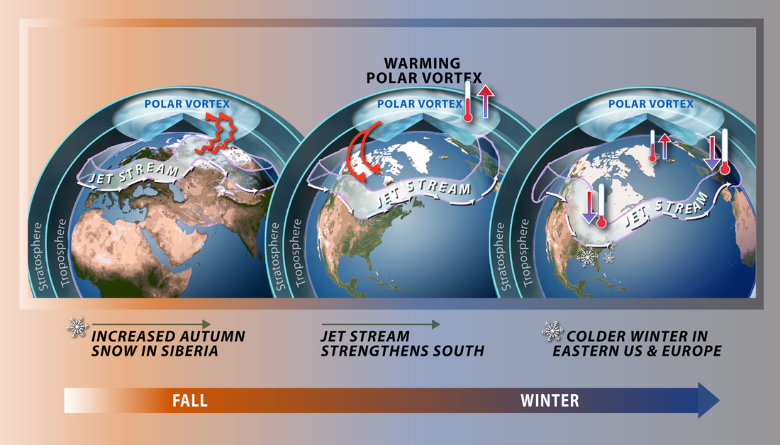
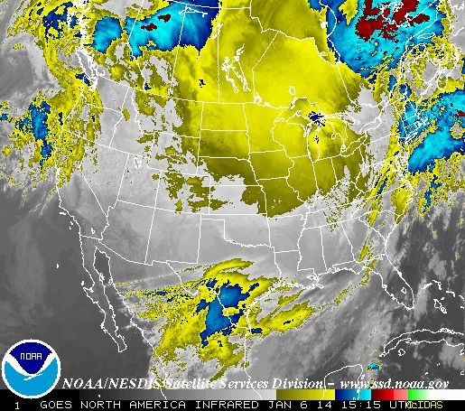
They happen occasionally at the North Pole, and their creation takes place after that of storms in additional tropical districts: quick moving winds advance around a cool focus. Polar Vortexes, are nothing new. Dissimilar to a typhoon, these are cold polar winds, surrounding the Arctic at more than 100 miles for every hour. The turning winds ordinarily trap this chilly air in the Arctic. In any case the issue comes when the polar vortex debilitates or parts separated, basically tossing these cool winds out of the Arctic and into our regions. Researchers have inferred that warming temperatures in the Arctic may be answerable for the debilitating of the polar vortex. The point when the vortex debilitates, its more inclined to break separated and turn into a component in our winter climate. Through the course of a winter, the ice air can get relocated southward, commonly into the eastern U.S. However it is phenomenal for such cool air to blanket such a substantial piece of the nation, happening perhaps once a decade or more. Weather.gov is calling for temps to be 20 to 40 degrees below average for the Northern Plains, Upper Mississippi Valley far into the Midwest. Tuesday the Northeast will get their share of the cold. Forecasters predict single-digit highs wanted in most parts of the area while temperatures will be in the high teens in Boston, New York City and Philadelphia. Tuesday's high of 14 degrees in New York City will be more than 40 degrees less than Monday's high of 55 degrees. These temperatures have forced state officials in Minnesota and other effected areas to issue public warnings. Urging people to stay bundled up, as temps this low can easily kill a person. Reports of supermarket shelves bare flood in as citizens prepare for the most bitter cold in decades. Schools were closed state wide Monday in Minnesota and Milwaukee. |
WBOB
|
Search For Your Favorite WBOB Author,
or BobCast
990WBOB
An Independent Media Outlet.
The views opinions and thoughts expressed do not reflect those of 990WBOB, its management or its staff. All Rights Reserved 990WBOB.com 2007-2020
Contact WBOB HERE
An Independent Media Outlet.
The views opinions and thoughts expressed do not reflect those of 990WBOB, its management or its staff. All Rights Reserved 990WBOB.com 2007-2020
Contact WBOB HERE


