|
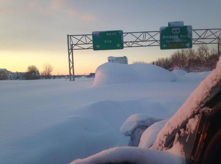
Snowstorms and record low temperatures whacked Western New York this week, and more wintry weather is still on its way. Areas surrounding Buffalo, New York, one of the hardest-hit areas, are buried under more than seventy (70!) inches of snow — with an expectation for 20-30 more inches by week's end. Watch 3 Amazing Videos Below More than 100 miles of the New York Thruway (I-190) were shut down between Rochester and Buffalo, as many stretches were non-navigable. State Police enlisted the use of snowmobiles to deliver blankets to stranded motorists, who were forced to wait many hours for rescue. Take a look at this time-lapse view of Lake Erie during the lake-effect snow storm of November 18th. This was taken from an office window in the Guaranty Building at Hodgson Russ. Also, see some amazing drone footage taken in a West Sneca, NY neighborhood. What is a "Lake-Effect Storm"? Lake-effect snow is produced during cooler atmospheric conditions when cold winds move across long expanses of warmer lake water, providing energy and picking up water vapor, which freezes and is deposited on the leeward shores. The same effect also occurs over bodies of salt water, when it is termed ocean-effect or bay-effect snow. The effect is enhanced when the moving air mass is uplifted by theorographic influence of higher elevations on the downwind shores. This uplifting can produce narrow but very intense bands of precipitation, which deposit at a rate of many inches of snow each hour, often resulting in copious snowfall totals. Drone Footage of Snowfall in West Seneca, NYMore AP Coverage of the Western NY Blizzard |
WBOB
|
Search For Your Favorite WBOB Author,
or BobCast
990WBOB
An Independent Media Outlet.
The views opinions and thoughts expressed do not reflect those of 990WBOB, its management or its staff. All Rights Reserved 990WBOB.com 2007-2020
Contact WBOB HERE
An Independent Media Outlet.
The views opinions and thoughts expressed do not reflect those of 990WBOB, its management or its staff. All Rights Reserved 990WBOB.com 2007-2020
Contact WBOB HERE


